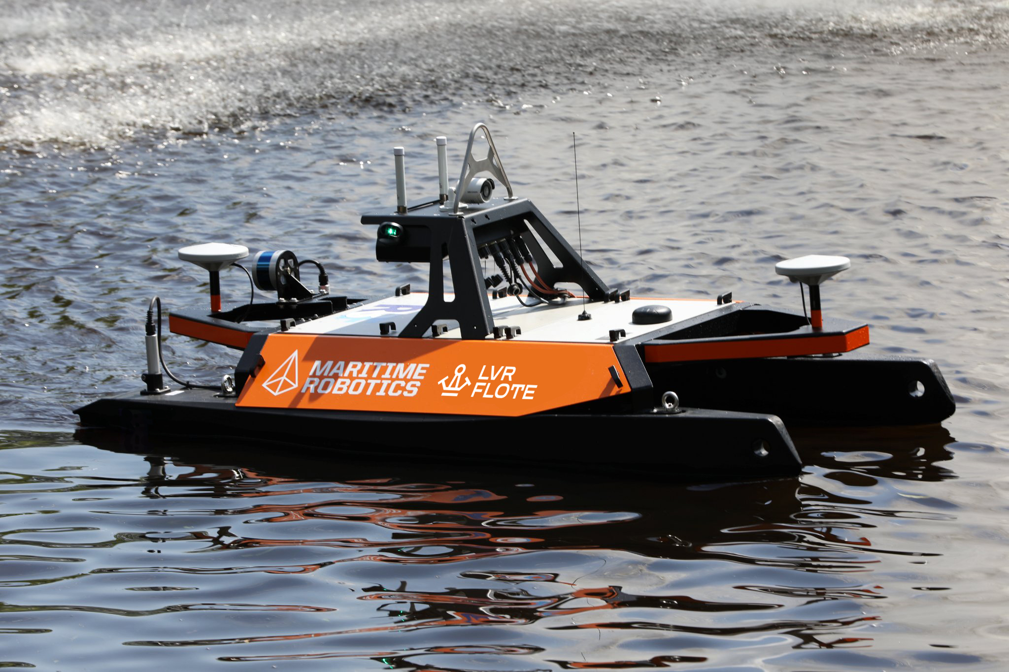
Floating drone or Unmanned Surface Vehicle (USV) OTTER is the ultimate hydrographic survey tool for mapping enclosed waters such as lakes, canals, rivers, ponds and harbor areas.
| Hull: | Catamaran |
| Measures: | 200 x 108 x 106 cm |
| Powered by: | easily interchangeable battery packs |
| Propulsion: | 2 electric thrusters |
| Max speed: | 4 knots/h |
| Equipment: |
|
Data acquisition using high resolution multibeam and LiDAR devices, 100% seabed coverage.
Depth resolution: 6mm
Data density: up to 5cm
Data acquisition in hard to reach locations and in close proximity to nearby structures
Very shallow water surveys up to 50cm
Final point cloud derived to customer’s required coordinate system
Depth/height coordinates in EVRS; LAS-2000,5
Final point cloud can be used to produce geospatial model
Data delivered electronically using XYZ, LAS / LAZ formats
Survey is done using calibrated and certified equipment